
Des Moines Neighbors Across Public Sources
“Neighbors” can mean owners of adjoining parcels, people in a historical street run, or public contacts for a civic area. Keep those meanings apart. A map establishes spatial relationships; assessor and voter tools report bounded administrative facts; directories and Sanborn sheets preserve dated block context.
| Source | What It Shows About a Block | Access |
|---|---|---|
| King County Parcel Viewer | Parcel boundaries, adjacent lots, IDs, and selected-parcel links | Free GIS |
| iMap and Assessor detail | Layers, intersections, situs, legal descriptions, and owner/name fields | Free map and search |
| MyVote or voter-data request | A known matched voter's address/status, or lawful public-file fields | Name and DOB match; requester and use limits |
| City 2025 map and civic pages | City limits, named roads, boards, commissions, and public meeting contacts | Free PDF and city pages |
| Directories and Sanborn maps | Dated names, addresses, structures, lots, and neighboring footprints | KCLS, State Library, and archives |
An assessor owner is not automatically an occupant, and a tax mailing address may lie elsewhere. A voter address is tied to one matched registration and update cycle. Describe each result by its actual role instead of merging the fields into a household roster.
Adjacent Des Moines Parcels Versus Nearby Places
A parcel sharing an edge is adjacent. A lot across an alley or street is nearby but does not touch the selected polygon. Parcel Viewer makes that distinction visible when the map is zoomed far enough to show lot lines and street names. It is more precise than assuming that consecutive house numbers share a boundary.
Record parcel IDs and situs addresses during the pass. Do not publish an owner-name sweep as a neighbor list. Geometry can explain who is next door, across the street, or simply close without turning county account fields into claims about who lives there.
Map the Des Moines Block Around an Address
Start with one known address and move outward only far enough to answer the block question. Parcel Viewer supplies the parcel bridge; Assessor details add situs and legal context; iMap supplies intersections, landmarks, and surrounding layers.
- Search the address in King County Parcel Viewer and select its polygon.
- Zoom until parcel edges, lot positions, and street names are clear.
- Click each adjoining polygon and record parcel ID and situs separately.
- Open Assessor details to compare legal descriptions and mailing fields without inferring occupancy.
- Use iMap for intersections, district layers, landmarks, and broader physical context.
Stop when the relevant edge, crossing, or radius is documented. For a whole named road and its records chain, use the Des Moines street directory rather than extending a block lookup indefinitely.
iMap Adds Context to a Des Moines Block
King County iMap accepts an address, parcel number, intersection written with an ampersand, or place and landmark term. Its layers help position a block among political and physical features, but the map does not create an ownership chain.
Des Moines' street pattern runs from the south-numbered grid toward shoreline roads such as Marine View Drive S, Redondo Way S, and Woodmont Beach Road S. The map context helps explain why a parcel that looks close by road may not be adjacent by lot geometry.
A Des Moines Block Is Not a Voter List
Washington MyVote requires a specific first name, last name, and date of birth. It can show address and status after a valid match, but it is not a tool for enumerating everyone on a block. A negative match may reflect a changed address, inactive status, protected record, or spelling issue.
The statewide voter extract is a separate administrative channel. It requires requester contact details, is updated monthly, may take up to five business days, and carries legal-use limits. RCW 29A.08.710 identifies public field categories while protecting full dates of birth, identification numbers, Social Security numbers, and original forms. RCW 29A.08.720 restricts commercial advertising, offers, and solicitation.
Note: Use voter data only for a known lawful question, and never treat it as a shortcut to a street roster.
Community Contacts Across Des Moines
No complete official Des Moines neighborhood-association map or directory was found in the sources reviewed. The proper fallback is the city's public-records route plus City Council, planning, boards, and commissions pages for recognized boundaries, charters, meeting notices, and public contact records.
The Des Moines boards and commissions page is the official starting point for public civic bodies and their current records.
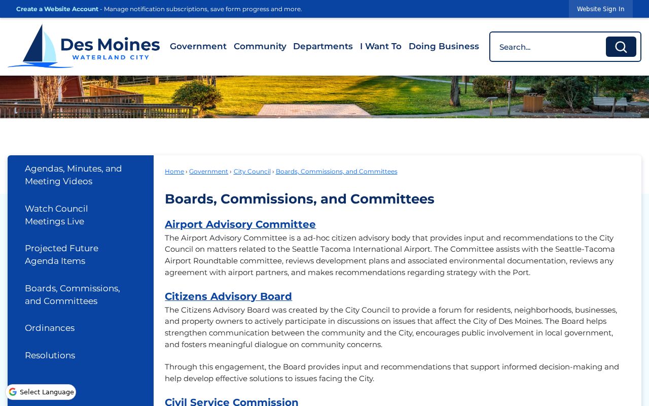
Its public-body structure is a community contact layer, not a roster of households or a substitute for a neighborhood association directory.
| Community route | What to request or review | Access |
|---|---|---|
| Des Moines boards and commissions | Public rosters, agendas, minutes, and meeting contacts | City civic page |
| City Public Records Officer | Recognized-neighborhood maps, charters, notices, or contact records held by the city | Online request route |
| KCLS and historical collections | Older community, directory, newspaper, and map context | Library and archive access |
The absence of a published umbrella directory should remain visible. It is not permission to invent association names or treat a private social group as an official neighborhood body.
Historic Des Moines Households in Block Records
A reverse or criss-cross directory can place listed names beside addresses in one edition, while a Sanborn map can show adjacent building footprints and uses. Exact Des Moines reverse-directory years were not verified, so ask KCLS or the State Library for the relevant volume and date.
Local terms such as Redondo, Woodmont, Zenith, Midway, North Hill, Maywood, and Angle Lake can unlock newspaper pages, images, and directory headings. These names reflect historical search geography and are not all interchangeable with today's incorporated city.
Official Records and Commercial Neighbor Tools
Official sources identify their custodian, field meaning, and update context. Parcel Viewer shows geometry; the Assessor shows account and land fields; MyVote verifies a known voter match; civic pages show public bodies. Each has a bounded claim that can be checked at the source.
Commercial neighbor tools compile data from many places. Profiles may merge same-name people, retain stale addresses, or omit the source date. Treat them as unverified leads, never as a substitute for a parcel, voter, directory, or city record. A discrepancy should send the search back to the official custodian.
Privacy Limits for Des Moines Neighbors
Washington's Address Confidentiality Program lets eligible participants use a substitute address in government records. A missing or substitute address can be a safety feature, not an error. Voter law protects full birth dates and major identification numbers; court displays also suppress addresses, phone numbers, birth dates, and personal IDs in many public views.
Do not infer that every person at a parcel appears in public records. Renters, children, relatives, and other household members may not be indexed, and an owner or tax-mail recipient may live elsewhere. Utility and delivery details are not supplied by the sources in this research.
Lawful use. Look up Des Moines neighbors for civic curiosity, reconnecting, or personal safety, never to watch, harass, intimidate, or harm anyone.
Publish the least detail needed to explain the block. Retain the lookup date and source qualifier, and direct correction or privacy questions to the custodian that holds the record.
Use the city map to keep civic and postal geography straight. The 2025 map places major routes and the city line beside a long numbered grid, but a Des Moines mailing label does not prove that a point sits inside the municipal boundary. Parcel jurisdiction and the official city line answer that question more directly. ZIP polygons, parcel polygons, and road centerlines may also have different dates and levels of detail.
Assessor fields need the same restraint. Situs identifies the land's site address, the owner/name line identifies an account role, and the mailing field identifies where tax correspondence goes. A mailing address outside Des Moines does not move the parcel, and a name on the account does not identify every person on the premises. Copy each label separately and state only that the official roll associated it with the parcel.
Historical block work can reveal a different set of Des Moines neighbors. A directory is fixed to an edition, a newspaper to its publication date, and a Sanborn sheet to its surveyed year. Compare house numbers and adjoining entries, then test the same block against parcel geometry and plat language. Do not slide a historical name into a current block description without a newer source.
Sanborn maps are particularly good at physical relationships. Their Washington coverage spans cities and towns from 1867 to 1970 and may show building footprints, construction material, use, and lot context. Shared walls, docks, stores, and outbuildings can explain how a past block functioned. They do not identify all occupants, and their printed address must still be reconciled with present parcels.
City boards and commissions are community sources of a different kind. Their public rosters, agendas, and minutes document civic roles and issues, not household membership. Planning and council records may mention a recognized area, meeting, or project. A public-record request should name the document, date range, subject, and neighborhood term so the city can locate responsive records without being asked to create a new directory.
King County Elections offers another formal request channel through its public-disclosure process, with voter-registration contacts documented by the county. That route does not erase state restrictions or turn the file into a casual neighbor tool. Request only what a lawful civic question requires. Preserve public and protected fields separately, and avoid publishing a streetwide extract when a summary or known-person confirmation answers the question.
Address Confidentiality Program records deserve special care. Eligible survivors and protected public-facing workers can use a substitute address that agencies must accept under RCW 40.24.050. The program does not remove every older public trace, but the appearance of a substitute or missing address should end attempts to infer the confidential location. Safety outweighs curiosity about a gap.
A block research log should include the starting address, map and layer dates, selected parcel ID, each adjoining parcel ID, which edges touch, roads or alleys between lots, and the source used for any administrative field. Add a separate dated column for historical directory or map findings. This structure lets another reader verify the geography without exposing a compiled household roster.
The final result may be modest: a map of parcel relationships, public civic contacts, and a few dated historical references. That is more accurate than claiming to identify every nearby household. Official systems were built for land, elections, postal service, and public administration, not as one current residents list. Their limits are part of the answer.