
Walk a Des Moines Street Record
The safest Des Moines street directory method moves from a normalized address to a parcel, then from the parcel to sources that record distinct people and events. Ownership is visible in Assessor and Recorder fields. Occupancy is harder. A voter match or dated criss-cross entry can support residence at a stated time, but neither proves every member of a household. Save the exact spelling, unit, directional suffix, ZIP, lookup date, and record date at each step.
- Verify the postal form, then search the address in King County Parcel Viewer or eReal Property.
- Copy the parcel number, situs address, legal description, owner/name field, jurisdiction, plat block, and lot.
- Click nearby parcels in Parcel Viewer to confirm the street segment and avoid a wrong lot or unit.
- Search Landmark Web by parcel ID or owner name, since the Recorder has no address field.
- For a known person, compare lawful voter evidence and dated reverse directories without treating either as a complete household list.
The flow is simple: address to parcel, parcel to owner field, parcel or party to deed index, then dated voter or directory evidence. If the goal shifts from a whole street to one named person, use the focused Des Moines resident lookup process.
Normalize Des Moines Street Addresses
Des Moines has a strong south-numbered street pattern. Official map terms include S 192nd through S 284th, numbered avenues such as 1st, 4th, 5th, 8th, 10th, 11th, 13th, 16th, and 24th Avenues S, plus Pacific Highway S, Marine View Drive S, Redondo Way S, Kent-Des Moines Road S, and Woodmont Beach Road S. Directional letters matter. So do apartment numbers, hyphens, and cross streets.
The 2025 official city map supplies current street and boundary context. Historical records may instead use Redondo, Woodmont, Zenith, Midway, North Hill, Maywood, Normandy Park, Manhattan, or Angle Lake. Des Moines incorporated in 1959, and a small November 1959 annexation north of S 216th and 13th Avenue South can change which place term works.
No official source located an exact citywide street-renumbering year. Preserve that uncertainty. When a number fails, compare cross streets, plat block and lot, legal description, parcel geometry, and the record's date instead of inventing a conversion.
Des Moines Parcel Search Fields
King County eReal Property accepts an address, parcel or property-tax account, and condominium or apartment-complex name. Its detail screen can expose parcel, name, site address and ZIP, jurisdiction, levy code, use, plat block and lot, quarter-section-township-range, legal description, land size, value, sale history, and building characteristics. The stable parcel and legal fields are vital when the street label changes.
| Tool | Field | Format or purpose |
|---|---|---|
| eReal Property | Address | Modern situs search |
| eReal Property | Parcel or tax account | Known property identifier |
| eMap | Parcel | 10 digits |
| eMap | Quarter, section, township, range | Geographic dropdowns |
| eMap | City levy code | Four digits |
| eMap | Map updated between | Beginning and end dates in mm/dd/yy |
The Assessor search shown here is the practical address entry point.
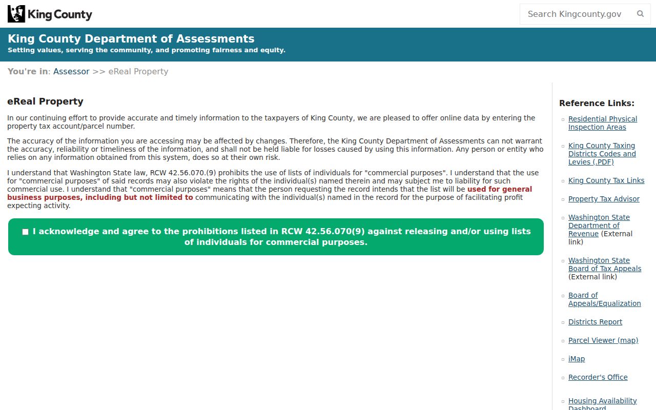
After finding the property, save the record fields separately rather than copying only the owner line.
Des Moines Street Records by Address
Several official sources accept or derive a Des Moines address, but they do not all list residents. The street directory is strongest when these sources are chained by parcel number, legal description, and date. Use the role shown by the record rather than calling every named person an occupant.
| Record Set | Keeper | What It Shows | Access |
|---|---|---|---|
| Assessor parcel detail | King County Assessor | Owner/name, situs, legal, use, land and building data | eReal Property |
| Parcel map | King County GIS | Lot polygon, adjacent parcels, map context | Parcel Viewer |
| Deeds and instruments | King County Recorder | Parties, dates, instrument, parcel and legal description | Landmark; older microfilm |
| Voter evidence | Washington SOS | Known-person match and lawful public fields | MyVote or extract request |
| Permits and code files | Des Moines and permit custodians | Applications, inspections, comments, address history | Portal or public request |
A parcel is a mapped land unit with a county identifier. The situs address is the property's physical site, while a mailing address is where tax correspondence goes. A plat is the recorded map that divides land into blocks and lots. A criss-cross directory sorts listings by address or phone, making it useful for historical street-by-street research.
Map Des Moines Parcels Together
King County Parcel Viewer supplies the bridge between street text and mapped land. Search by address or parcel, zoom to the lot, then click the parcels on both sides and across the street. Record each parcel ID and situs address. Map adjacency means the lots touch or sit nearby. It does not prove that the named owners are neighbors in daily life.
The viewer links toward Assessor details and district or development reports. King County iMap adds political boundaries, natural resources, real property, and place or landmark layers. These layers can explain why the same block carries different district, shoreline, postal, or municipal labels. They are context, not a resident list.
For shoreline roads and marina-area parcels, the legal description may be more reliable than the street label. Save plat block and lot plus quarter-section-township-range. A map click can recover a parcel even when the situs address is missing or formatted differently.
Des Moines Owners Are Not Occupants
The Assessor's owner/name field, situs, and tax mailing address describe different facts. A Des Moines parcel can have an out-of-city mailing address. An owner may not live on the land. Conversely, an occupant may never appear on the parcel account. A deed party, tax-mail recipient, voter, directory listing, and permit applicant also have distinct roles.
Label the evidence precisely: owner/name field, situs address, mailing address, grantor, grantee, applicant, registered voter, or listed occupant. Include the record date. If two sources conflict, keep both entries and look for a later deed, voter update, permit, newspaper notice, or dated directory rather than selecting the more convenient answer.
Note: Never publish a current-resident claim based only on the Assessor name or tax mailing address.
Des Moines Deeds Need Parcel IDs
Landmark Web has Name, Document, Book Page, Consideration, Parcel ID, date, instrument, legal, and Torrens searches, but no address field. The Recorder directs address users to Parcel Viewer. Once the parcel or owner is known, a deed search can reveal deeds, deeds of trust, reconveyances, liens, easements, plats, recording numbers and dates, parties, and legal descriptions.
Online record images generally begin August 1, 1991. For older records, King County Archives holds microfilm covering recorded material from 1853 through July 31, 1991. The archive has self-service lobby readers and publishes visit and appointment information. A hidden Landmark image may require a copy request or restricted-record route.
The Recorder search interface below displays the field routes used after a parcel is found.
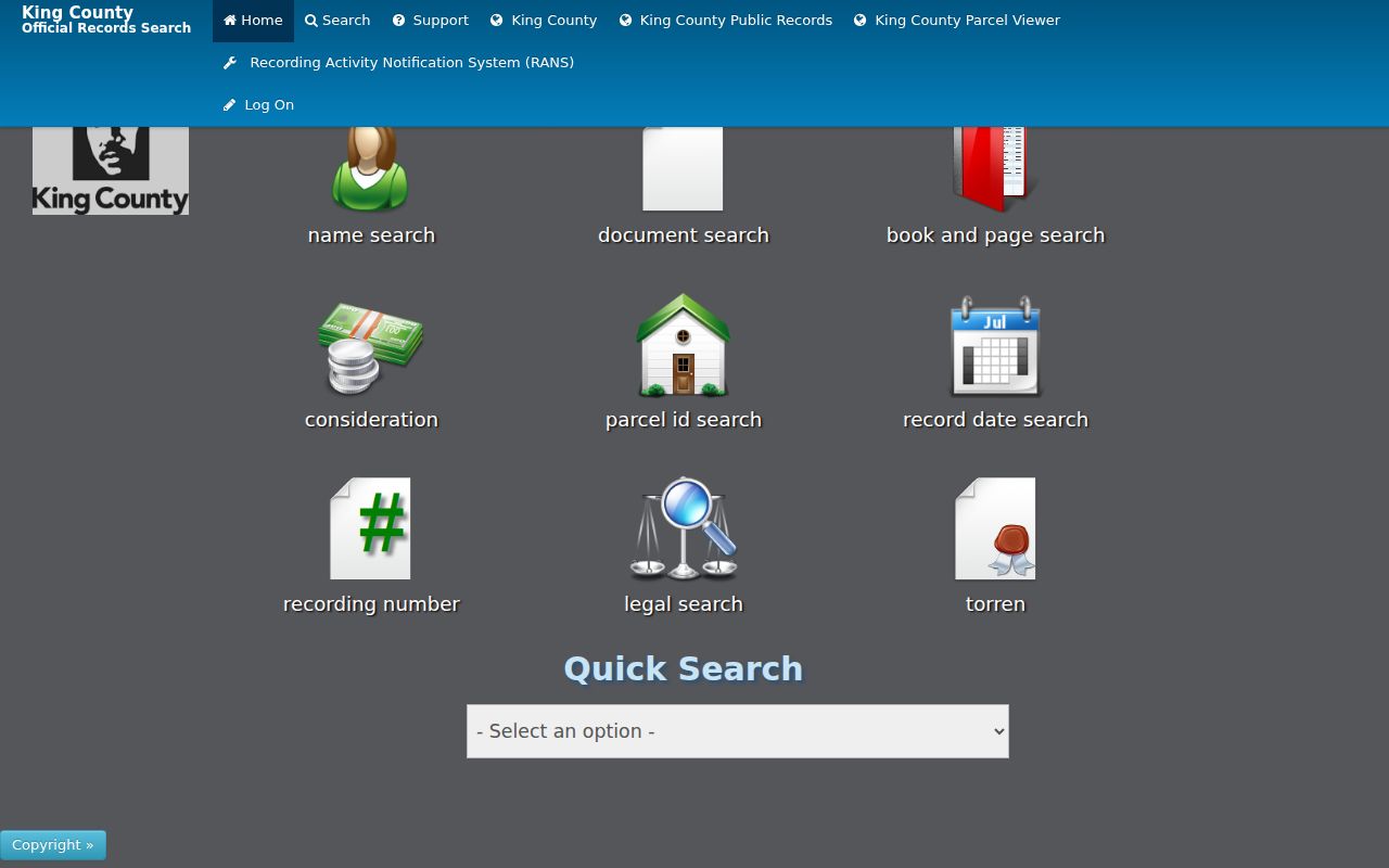
The multiple tabs support deed-chain work, while the missing address box explains the required parcel-first handoff.
Des Moines Permits by Site Address
Permits and code records add events to a Des Moines street directory. MyBuildingPermit and local custodians may show applications, inspections, comments, and address history. Washington L&I also provides permit search fields for electrical and manufactured or mobile-home work. The applicant or contact on a permit should not be labeled as an owner or resident unless another record establishes that role.
When the visible portal lacks the full file, use the Des Moines public-record request process. Give the normalized address, date range, permit or case number, department, and desired file type. The city's report-a-concern pages expose code and service categories, but a complaint route is not a public address index. Ask the custodian for an identifiable existing record.
City police records also use a request channel for case files, body-camera material, and collisions, subject to exemptions. Keep those event records separate from a household roll.
Des Moines code and permit files can also resolve a date question when a parcel detail is too broad. Ask for the application, inspection log, correction notice, decision, and attached site plan for a defined address and period. Record the name exactly as the file labels it, such as applicant, contractor, contact, complainant, or owner. Those labels explain why the person appears and guard against a false claim that the person occupied the property.
Des Moines Streets in Older Sources
Criss-cross directories can arrange names by street or telephone number, but no official page located a complete Des Moines reverse-directory run. Search the Washington State Library guide and KCLS history resources by city, county, telephone directory, criss-cross, year, and publisher. Confirm each volume's scope before using it. The State Library's broad 1890-present statement spans many cities and does not guarantee each local year.
KCLS provides Sanborn maps for Washington towns and cities from 1867 to 1970. A Sanborn map shows structure footprint, materials, use, and block context, not occupants. Pair it with a directory, deed, newspaper, or assessor record. DMHS newspapers begin in 1946 and its collections include photos, monographs, glass negatives, tintypes, and maritime materials.
For the full shelf and entry method, consult the Des Moines city directory research. On a street search, record the directory title, publisher, year, page, address section, abbreviation key, and names around the target.
ZIP Layers Cross Des Moines Streets
Official King County material confirms 98198 for Des Moines. ZIP codes route mail, while city limits define municipal jurisdiction and parcel lines divide land. Those boundaries can overlap without matching. USPS historical material associates nearby 98148 with Burien, so do not broaden a Des Moines street directory search to that ZIP without verifying the exact address.
Use USPS to standardize a full address, King County GIS for the ZIP polygon, the city map for municipal streets, and Parcel Viewer for the lot. The Assessor's site address includes a ZIP, but it should be read as one property field. None of these layers lists everyone who lives in the area.
Boundary date matters too. Compare the record year with Des Moines incorporation and annexation history. An old address may be indexed under King County, a precinct, or a nearby community name even when the modern parcel is inside Des Moines.
Limits of Des Moines Street Directory
No official source offers a complete, live roll of everyone on a Des Moines street. Parcel tools center on land and tax accounts. Deeds document recorded interests. Voter sources are limited by law and may be stale, inactive, or protected. Directories are dated and incomplete. Utility customer data, motor-vehicle addresses, sealed court matters, protected identifiers, and many personal records are not open street-search material.
Washington's Address Confidentiality Program under chapter 40.24 RCW lets eligible participants use a substitute address while restricting the actual address in government records. A negative search can also result from spelling, a unit mismatch, recent move, delayed update, or record exemption. Report only what the source shows at the time checked.
Lawful use. Des Moines address records are for legitimate personal research. Never use a street search to stalk, harass, intimidate, expose, or harm anyone.